A map that remembers the analysis
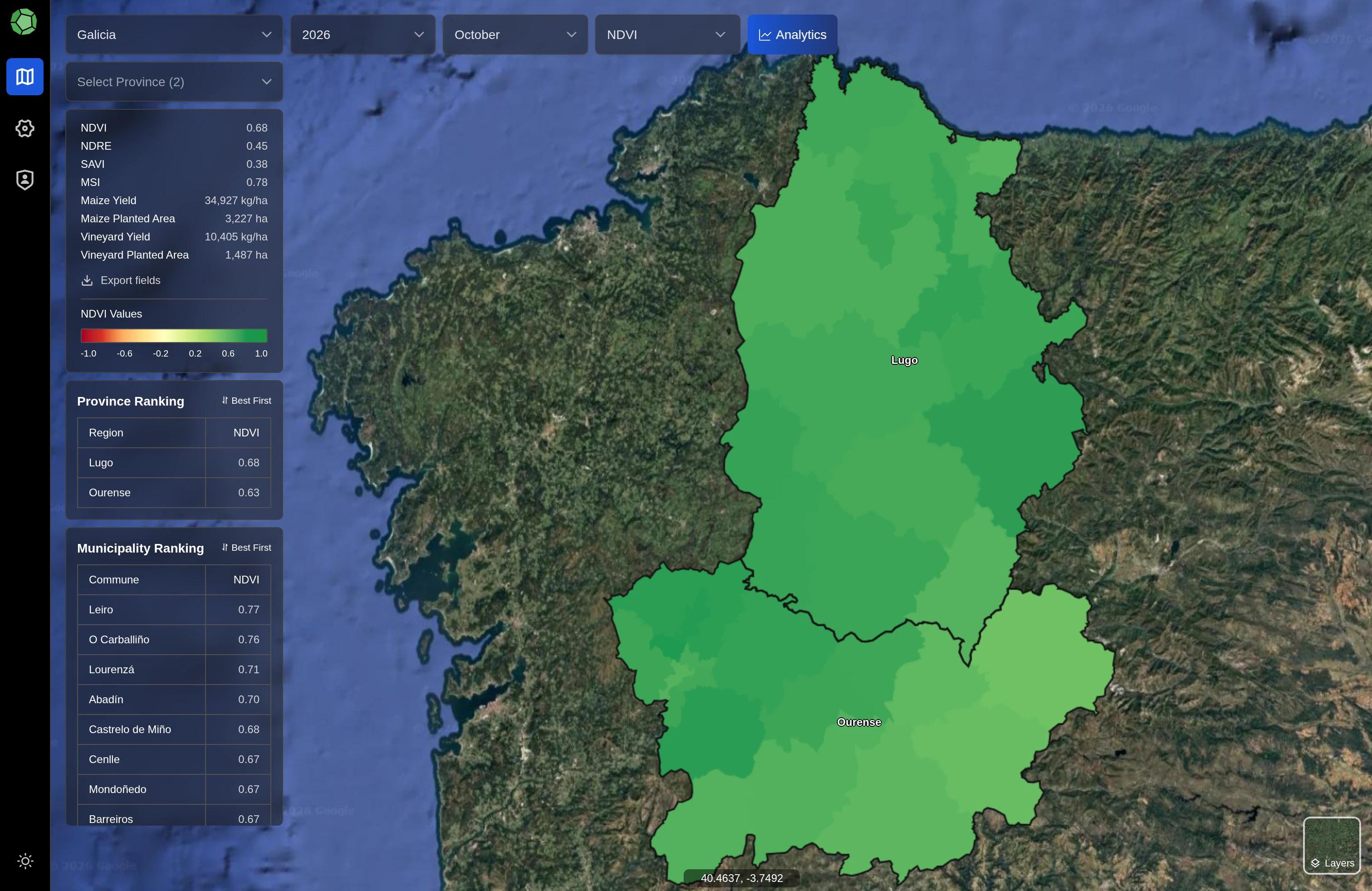
Region, province and municipality navigation preserves season, month, crop filters, selected feature and the exact camera position in a shareable URL.
Crop parcels, satellite indices and seasonal history, brought together in an agricultural mapping application.
The engineering challenge
A map value is only useful when its date, coverage and source remain clear. This application brings administrative geography, annual crop records and changing satellite observations into the same analytical view.
Stable parcel geometry stays separate from annual observations. A dedicated worker prepares quality-screened satellite products, while the map reads a consistent completed data revision.
Explore regional patterns, inspect a parcel’s history and compare selected years without losing the crop, season or map position.
Conceptual workflow · not an application screenshot
Choose area + season
Filter crops + index
Inspect parcel history
Compare years + share
What we built
Region, province and municipality navigation preserves season, month, crop filters, selected feature and the exact camera position in a shareable URL.
NDVI, NDRE, SAVI and MSI connect consistent legends to field history and regional summaries.
Cloud screening, bounded historical gap filling and valid-coverage records distinguish unavailable observations from real low values.
Compare imported yield estimates for one or two years at municipality level, with signed changes and area-aware summaries.
Stable geometry, annual crop observations and administrative membership let the same parcel participate in historical analysis. Area-aware membership helps avoid double-counting across boundaries.
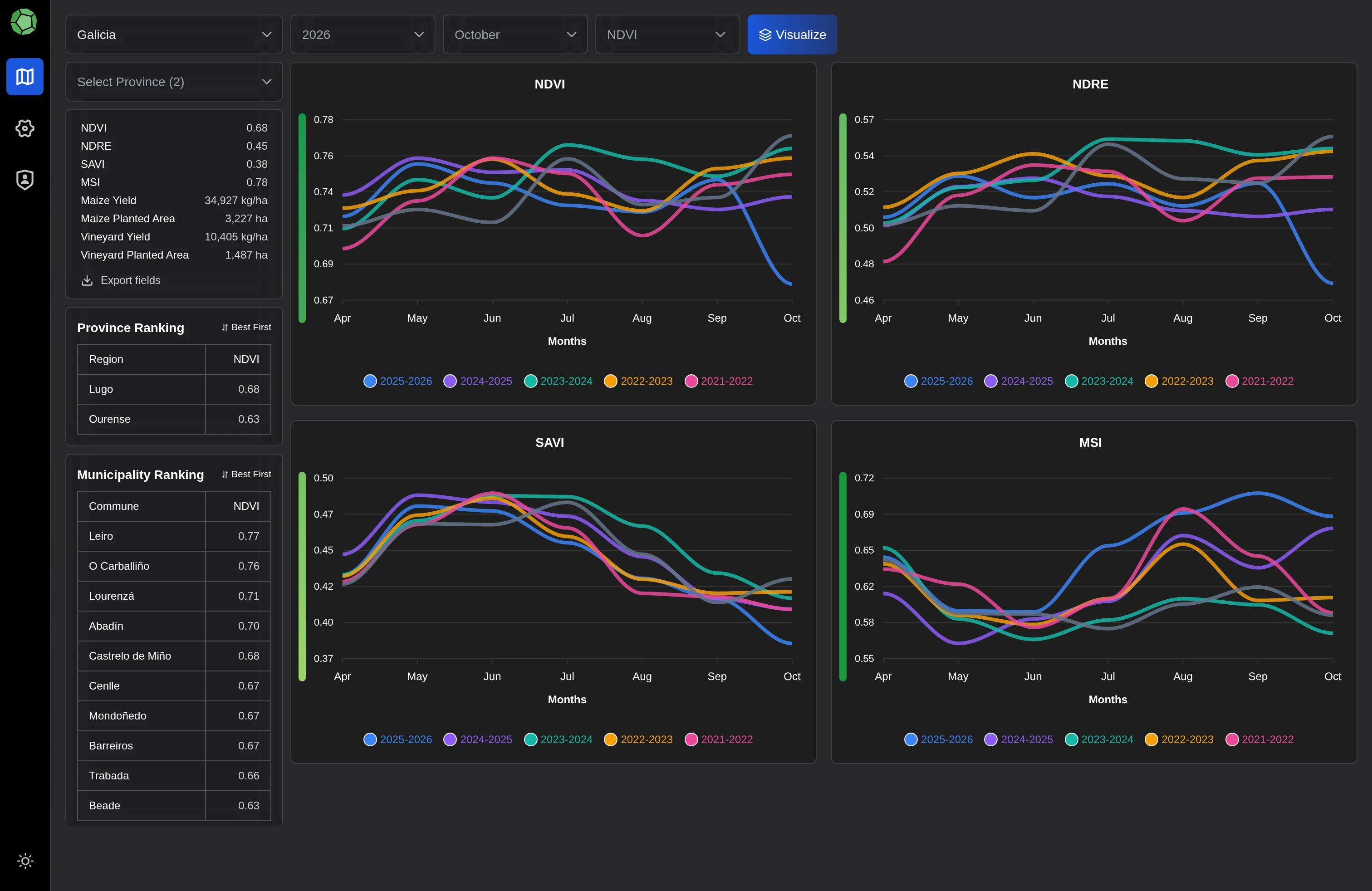
Yield comparisons use imported source estimates. Satellite observations follow a quality policy; unavailable values remain unavailable. These are analytical views, not a newly validated yield prediction model.
Build with AlgoFly
This is a private client application. Explore the engineering story, or talk with us about your own workflow.